Friday, July 19, 2013

Day 7 - July 18 - North Bay to Niagara-on-the-Lake

Weather: AM: Sunny and Cloudy Periods +28c
PM: Rain (Heavy) + Sunny, extremely humid, +41c
Distance: 567km, time 8hrs

This will be the last day of my Pinetree Line Motorcycle trip, having returned to North Bay last night I was back to my starting point of North Bay and again Hwy #11.

Got a real early start at 8:00am and headed for home making a stop at Elmsford which is adjacent to the CN Newmarket Sub and while doing some video out-takes would you know along come CN#451 (Toronto-North Bay) freight, this train will become the ONLY CN train that we saw all week.

There was one Pinetree Line radar site still to be checked out at Edgar, which is between Barrie and Orillia, not much left here other than the guard house and the community centre building, and there was a big backhoe sitting there, so maybe it will be all gone in a week or so.
Guard House CFS-Edgar

Community Centre Building CFS-Edgar

Interesting view of the interior of the Community Centre building, note the raised platforms forming some kind of a stage.

CFS-Edgar, some of the roads.  Now just ghost of the past remain on the site, sometimes you feel a presence, like here.

That raps up 7 days on the road, hit some heavy rain just North of Toronto, only lasted 5 minutes did not bother with rain gear it was +40c and I was dry in less than 2 minutes as were the roads, but lots of heavy traffic on the 400, 407 and QEW.  I was glad to be home a 4pm and the welcome of the air conditioned house.

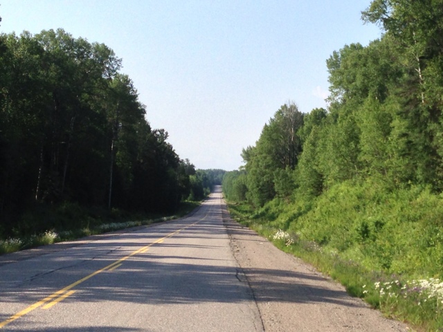
Ken on his motorcycle in Northern Ontario, somewhere out there.

Quick Summery:
Total distance:  3,157km 
Time:  7 Days
Motels:  4 nights (stayed at Ben's 2 nights)
Weather:  Typical Summer HOT and Very HUMID
Wildlife:  1 Turtle (No moose and No Bear) 
Bike Issue:  None (bike is dirty with lots of bugs as is my riding gear but it has all been wahsed)


Wednesday, July 17, 2013

Day 6 - July 17 - Chapleau to North Bay

Weather: AM: Sunny and Cloudy Periods +22c
PM: Partly Sunny, very humid, +40c
Distance: 567km, time 9hrs 30mins

We got an early start this morning, and after a brief stop at the CP Station in Town and the steam loco display it was time to hit the road, we are travelling down Hwy#129 and #554 to Iron Bridge back on the Trans Canada Hwy#17.  There are NO services on #129 and NO gas for 210km, so the rule in the North is gas often, so with full tanks and ranges around 260km for each of our bikes we will not face any problems.

CP Steam Loco #5433 2-8-2 at Chapleau, ON

About 40km South of Chapleau you cross (ie. hight of land) from the Arctic Ocean to the Atlantic Ocean Watershed, we crossed this back on last Saturday near New Liskard and again near Wawa.  There is a sign board at each crossing point.
That is me with Morley, the only complaint Morley he had was there were NO moose sighting on this trip nor any bear.  There weren't any trains either except the ONR Polar Bear Express back on Sunday.

A view of Hwy#129 somewhere out there!

Hwy#129 along the Mississagi River

Jct of #554 and #129 about 20km North of Thessalon
 
Highway 129 has lots of twists and some breath taking scenery, it is like the Tail of the Dragon, except almost no cars, but there is the Moose and Bear issues, which may not exist on the Dragon, so keep that in mine, plus if you need help it is hours away.

We reach Iron Bridge in about 3 hours, so just a bit before noon, but there are not any restaurants in town and even the gas station has issues in getting the pumps to work and the credit card machine, and this is an Esso, but they do have 91 gas, so many in the North only have 87.

So Blind River will be the lunch stop at 12:30 and it has lots of restaurants, and even a hospital as well.

During lunch we decided to push on to North Bay and skip the tour of Manitoulian Island and taking the ferry to Tobermory.

We did notice around 3pm the temperature dropped to 35c and there was sign of rain before, we never got a drop of rain but appreciated the cooler temperatures, relatively speaking.
 
We stayed on 17 right through Sudbury and on to North Bay, arriving back at Ben's house at 6pm sharp, not bad for a 500+km day, and we did not follow our rule of not exceeding 500km, sometimes you need to live on the edage.

Tomorrow I will drive back down Hwy#11 and home, and completing my Pinetree Line Road Trip, so far I have ridden over 2,600km.


Tuesday, July 16, 2013

Day 5 - July 16 - Terrace Bay to Chapleau

Weather: AM: Sunny and Cloudy Periods +10c
PM: Partly Sunny, very humid, +34c  
Distance: 440km, time 7hrs

We got an early start this morning at 8:30 and found a nice bakery in Terrace Bay for breakfast.

Our first stop of the day is Marathon, the paper mill is now shut down, but the town is prospering on the mega gold mines at Hemo, about 25km to the East.  There is a new mall and a very large Canadian Tire.
Shutdown Mill in Marathon.

After our brief ride around Marathon, we are off to Hemlo.  About 25km East of Marathon is the Hemlo Gold Fields, this is one of the largest gold discoveries in the world, there are two operating mines.

Hemlo Gold Mine

Next up White River - this place has seen better days, the CP Rail yard was empty, not a train in site.  The stations needs a facelift, and there is still one VIA RDC Train which operates every other day, but that train has very few passengers and is only designed to serve communities with no roads between White River and Sudbury. 

CPR White River, ON

We also made White River the lunch stop which was a good idea as a massive rain storm was happening about 15km to the East, so we avoided getting wet and only found some wet roads, but the lunch was expensive $18 for a grilled cheese sandwich, soup and a soft drink - captive audience.

It will be another hour and 15minutes to Wawa, where we will leave Highway 17 (the Trans Canada) and head East on Hwy #101, though the deep woods of Ontario and no Gas, No Towns, nothing!

The Canada Goose at Wawa, on Hwy#17

Wawa was only connected to the rest of the world in 1960, that is when the last section of the Ontario to Manitoba highway 17 was completed.  That was a big issue for the town, up to them the Algoma Central Ry was the means of transportation to Sault Ste. Marrie.

On our way to Chapleau just outside the Shoals Prov. Park I had to make a turtle rescue on Hwy#101, this guy was crossing right across the road, so I helped shorten his journey.  Anyway he knew the Euclid but had not met him.

This great rapids is on the Jackpine River, between Wawa and Chapleau and the highway is deserted  as you see in the next photo.
Hwy#101 Pine Trees love sand (lots of sand).


Chapleau was a welcome sight as the temperature was now 34c and with the humidity is felt like 43c, anyway we travelled a fair distance today and we found a very nice modern hotel/motel and a welcome shower at the end of 440km.


Monday, July 15, 2013

Day 4 - July 15 - Longlac to Terrace Bay

Weather: Cloudy/Rain +20c humid, with rain showers in the morning and periods of cold (10c) mist in the afternoon.  
Distance: 364km, time 6hrs

This was a day that started out with lots of rain, and it rained very hard overnight.  We left Longlac with the Gas we had on board, as they only had 87 octane gas and we need 91 or 94.  We discovered that in the North 87 is the norm, anyway we had 30km to get to Geraldton and the Husky station with 91 gas.  I was fine still had 4.5L and one bar left, but Ben ran out 50ft from the station and coasted in.  It wouldn't be a road trip without one incident.

Geraldton is "a big place" with 2,500 persons, but the old CN Rail line to Thunder Bay (the Kinghorn Sub) is now gone as is the station, glad I got a photo back in the 1980's.

Geraldton is on the Ring of Fire, this is Ontario vast Gold and Diamond deposit which are now being developed in the North, you see this sign all over the place, as do you see massive construction trucks being moved on the highway.  Point on Hwy#11 the road is great shape up to Hearst and then it is a bit rough going to Longlac and even rougher in to Nipigon where it meets Hwy#17.

The old CN line through Jellicoe which has an abandoned bunk house.

Here on Hwy#11 is a massive Dump Truck (a CAT) being moved under police escort, but it won't fit through the bridge construction site unless they take down the temporary traffic light, so we are stopped fro about 15minutes.  Just another day on the road of life's adventures.

Now the Roxy Place in Beardmore has seen better days for sure, but this is a classic old theater building and worth the photo.

Lunch today will be in Nipigon at the Nipigon Cafe, a small family run business, not fancy but the food was good and the so was the price, plus in looked over the CPR main line - not a train in sight, these railway lines are very quite.

A very typical shot of the Trans Canada Highway (Hwy#17) near historic Rossport, ON.

Rossport Harbour on Lake Superior.  (Note of the fog and mist)

Rossport has a population of 130, but back in the late 1700's this was a major port on the lake and played a role in the building of the Canadian Pacific Ry.

We stopped briefly in Schreiber (once a a very busy CP Division Point)

You can see from the photo, not a train, car etc.. in sight.  The place is dead.

On to Terrace Bay for the night.  Arriving at 4:30pm, a bit tired, as riding in the rain is not fun.  A crow took off from the far side of the road and headed right for me, I thought it would strike me on my helmet, no, but it did hit the headlight dead centre and was dispatched to the side of the road - not what I intended to have happen.


Day 3 - July 14 - Cochrane to Longlac

Weather: Cloudy +31c very humid, with rain showers late in the afternoon. 
Distance: 440km, time 8hrs 30mins

Before leaving Cochrane we caught the ONR POLAR BEAR EXPRESS train which was a few minutes leaving the station on its 190km run to Moosenee, it had 3 flat cars of automobiles and lots of coaches, it looked like a full train.  Sunday is the day that everyone who works in the two diamond mines head back to work for Monday.  This area of Ontrario and for that matter Canada is booming, everyone in Tim Hotons at 8am was paying with $50 bills.


We finaly got underway at 9:15 on Highway 11, now heading due West, and within the hour we were in Smooth Rock Falls, looks like the mill is now closed, but the hydro dam is still generating power and the place is still being lived in.  I can see why some call this the Route 66 of Canada, it has that feel of abandonded towns andbusinesses.

Next stop is Kapuskasing
ONR Station (ex CNR)
The Tembeck Paper Mill in Kapuskasing, ON

The orginal height finder rader from CFS Lowther is on display at the train sation, so we used that spot to hand out the offical trip patch.
Ben and Ken holding the trip patch.

The official trip patch and the topo map of the area between Smooth Rock Falls and Kapuskasing


Old still in use TCT (Trans Canada Telephone Microwave Tower) Tower, to the West of Herest, ON, still in use that it is a relec of the early 1950's.

Our goal was to find CFS Lowther, the site is gone, there are NO buildings and I did find what I think was the access road.  But of interest was the ex CN Railway Line, just outside Lowther was an old telephone pole with a massive cross connect box, which must have tide into the base back in the 1950's, of course all of this is abandoned (railway line is still in use).

Hearst Sta (joint use) ONR and CN (ex ACR).

Our lunch stop is Hearst, ON

After lunch we are off at 2:30pm for 220km stretch of Hwy#11 with NO GAS, we arrived in Longlac, after some delays becasue of rain etc..  But we did arrive 3 hours after leaving Hearst, which was the last town with gas.

Some photos from the Hwy#11
Ken at MP 1004km from Toronto on Hwy#11 also known as Younge Street.
Ben celebrating Black Fly season in the middle of Hwy#11, not much traffic on Sunday, in fact very little, like maybe be 4 cars and 4 trucks in an hour, this area is far North for sure.

We stayed over in the Westway Motel/Hotel, it was like a big city hotel, with an elevator too and very nice rooms.  This for a town of 1,500 people.


Saturday, July 13, 2013

Day 2 - July 13 - North Bay to Cochrane

Weather: Sunny +31c little humidity, made for nice riding weather.
Distance: 394km, time 8hrs 

Today was our first full day on Highway #11, we travelled due North from North Bay to Cochrane, but we did have a few stops on the way.  First one was the ONR Station in Temagami.

After a lunch stop in New Liskard it was off to the ONR Division HQ in Englehart, which was very quiet with no trains, however since last September they have finished re-painting steam engine #701, and it is an excellent job, see this photo.


Next stop was CFS Ramore.  That is Canadian Forces Station, and yes it is abandoned but with a little detective work and the advice of some locals we found an almost intact Pine Tree Line Radar site.

So was is left, the Guard House, all the maintenance garages and over 12km of paved road, including one leading to the very top of Lava Mountain.  Now to get to the top or the last 1.7km requires about a 20 minute hike or if you have the skill and you can get an 500kg motorcycle over dirt and a small space you can cut that to 5 minutes.

Guard House

The Access Road

The Radar Tower Base

Ken's Bike on site at CFS Ramore

Warning: Asbestos present in this old building

The Aux Radar Tower

A almost in tact GE Mastr radio unit, I can almost here the cryptic com "CFSRAMORE INCOMING DETECTED"  If I had the car this would be heading home, what a find a item of technology from the Cold War like it was only yesterday.

Another Road view - this place had a staff of 800 in the 1950 and was one of the largest Pinetree Sites.

After spending more than an hour at Ramore it was time to hit the road, we still have 47km to go and it was 4:45pm, but the sun sets at 9:24pm, when you are north of 49!

Cochrane for the night.

Just an unbelievable day and an excellent fine a Ramore!!


Friday, July 12, 2013

Day 1 - July 12 - Niagara-ont-the-Lake / North Bay

Day 1 - July 12 - Niagara-on-the-Lake / North Bay

Weather: Sunny +26c little humidity, made for nice riding weather.
Distance: 463km, time 6hrs 5mins

Today was a 6hr ride from Niagara-on-the-Lake to North Bay, this trip is starting from North Bay as
I am riding with my long time friend Ben.  I have noticed now that clutch is no longer slipping at high
speeds that my distance per tank of gas (20L) has increased to about 320km, vs 230km, so there
was only one gas stop for the trip.

Tomorrow we will be heading out in the morning for Cochrane and the abandoned radar site at 
Ramore.